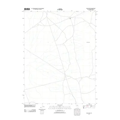
2012 Map of Beck Pass
USGS Topo · Published 2012About this map
Beck Pass serves as the central focal point of this arid landscape in eastern Nevada, situated within White Pine County. The terrain is defined by a network of unimproved roads and ephemeral washes that cut through the valley floor, illustrating the typical high-desert drainage patterns of the Great Basin. To the east, the prominent rise of Dry Mountain anchors the topography. This 2012 survey provides a precise look at the sparse infrastructure of the region, where transportation is limited to rugged tracks and state-maintained routes that navigate the gaps between these significant geological formations.
Find a feature on this map
2 named features on this map. Tap any name to fly to it.
Don’t see what you’re looking for? This feature index may not catch every label — zoom into the map to look around manually.
Map Details
Editions of this 2012 Beck Pass Map
This is the sole edition of this map. No revisions or reprints were ever made.
Other maps of this area

1951 · Illipah
USGS Topo · 1:62,500

1951 · Pancake Summit
USGS Topo · 1:62,500

1956 · Ely
USGS Topo · 1:250,000

1957 · Buck Mountain
USGS Topo · 1:62,500

1959 · Ely
USGS Topo · 1:250,000

1963 · Ely
USGS Topo · 1:250,000

1979 · Mt. Hamilton
USGS Topo · 1:100,000

1982 · Sunshine Well
USGS Topo · 1:24,000
1982 · Sunshine Well NW
USGS Topo · 1:24,000

1985 · Newark Lake
USGS Topo · 1:100,000