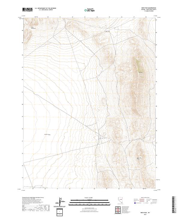
2021 Map of Beck Pass
USGS Topo · Published 2021About this map
Beck Pass serves as a critical geographic transition point in this high-elevation corridor of eastern Nevada. The landscape is defined by the intersection of the Ruby Mountains to the northwest and the northern reaches of the White Pine Range to the southeast. These distinct mountain masses frame the eastern edge of the Newark Valley, a broad interior basin where the terrain flattens significantly from the steep contours of the surrounding peaks. The topography here illustrates a classic Great Basin pattern, where prominent landforms like Dry Mtn provide essential landmarks for navigation across the high desert. This 2021 update, utilizing modern data from the U.S. Census Bureau and Bureau of Land Management, provides a clear view of the public land survey system divisions across Township 20 North and Township 19 North.
Find a feature on this map
9 named features on this map. Tap any name to fly to it.
Don’t see what you’re looking for? This feature index may not catch every label — zoom into the map to look around manually.
Map Details
Editions of this 2021 Beck Pass Map
This is the sole edition of this map. No revisions or reprints were ever made.
Other maps of this area

1951 · Illipah
USGS Topo · 1:62,500

1951 · Pancake Summit
USGS Topo · 1:62,500

1956 · Ely
USGS Topo · 1:250,000

1957 · Buck Mountain
USGS Topo · 1:62,500

1959 · Ely
USGS Topo · 1:250,000

1963 · Ely
USGS Topo · 1:250,000

1979 · Mt. Hamilton
USGS Topo · 1:100,000

1982 · Sunshine Well
USGS Topo · 1:24,000
1982 · Sunshine Well NW
USGS Topo · 1:24,000

1985 · Newark Lake
USGS Topo · 1:100,000