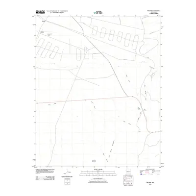
2010 Map of Becker
USGS Topo · Published 2010About this map
Becker and the northern reaches of the Los Pinos Mountains define this high-desert landscape in Valencia County. The terrain is marked by dramatic elevation changes, notably at Whiteface Mountain and where the Abo Arroyo enters the deep incision of Abo Canyon to the east. Modern residential and ranching infrastructure appears in the north, evidenced by a network of winding roads like Diablo Dr and Ingresso Dr, as well as the Burris Ranch Number 1 Airport. Local industry and land use are concentrated along the eastern drainage systems, where the Blue Springs Quarry sits near Blue Springs and the Goat Ranch. This survey captures the transition from high plains to mountainous breaks, tracing ephemeral watercourses such as Pino Draw and Goat Draw through the arid landscape.
Find a feature on this map
26 named features on this map. Tap any name to fly to it.
Don’t see what you’re looking for? This feature index may not catch every label — zoom into the map to look around manually.
Map Details
Editions of this 2010 Becker Map
This is the sole edition of this map. No revisions or reprints were ever made.
Other maps of this area

1916 · La Joya
USGS Topo · 1:125,000

1917 · Estancia
USGS Topo · 1:125,000

1952 · Tome SE
USGS Topo · 1:24,000

1952 · Black Butte
USGS Topo · 1:24,000

1952 · Turn
USGS Topo · 1:24,000

1952 · Becker SW
USGS Topo · 1:24,000

1952 · Becker
USGS Topo · 1:24,000

1952 · Cerro Montoso
USGS Topo · 1:24,000

1954 · Torreon
USGS Topo · 1:62,500

1954 · Socorro
USGS Topo · 1:250,000