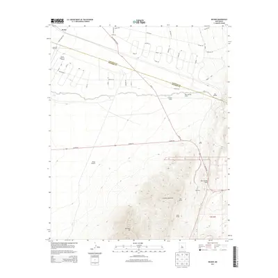
2013 Map of Becker
USGS Topo · Published 2013About this map
The Valencia Co Socorro Co line bisects this landscape, where the high desert terrain meets the eastern slopes of the Los Pinos Mountains. In the northwest, the settlement of Becker sits near the tracks, while ranching legacies are visible at West and Pyle Ranch and the Burris Ranch Nr 1 Airport. The topography is defined by significant drainage systems and vertical rises, most notably Whiteface Mtn and the deep cut of Abo Canyon. Modern residential development is evident in the sprawling network of circular drives and loops like Diablo Loop and Tierra Grande Loop north of NM-47. This transition from traditional ranching lands to planned communities is a primary characteristic of the area, as seen in the extensive street grid of Rio Communities Blvd contrasted with the remote Goat Ranch and the rugged Pino Draw.
Find a feature on this map
44 named features on this map. Tap any name to fly to it.
Don’t see what you’re looking for? This feature index may not catch every label — zoom into the map to look around manually.
Map Details
Editions of this 2013 Becker Map
This is the sole edition of this map. No revisions or reprints were ever made.
Other maps of this area

1916 · La Joya
USGS Topo · 1:125,000

1917 · Estancia
USGS Topo · 1:125,000

1952 · Tome SE
USGS Topo · 1:24,000

1952 · Black Butte
USGS Topo · 1:24,000

1952 · Turn
USGS Topo · 1:24,000

1952 · Becker SW
USGS Topo · 1:24,000

1952 · Becker
USGS Topo · 1:24,000

1952 · Cerro Montoso
USGS Topo · 1:24,000

1954 · Torreon
USGS Topo · 1:62,500

1954 · Socorro
USGS Topo · 1:250,000