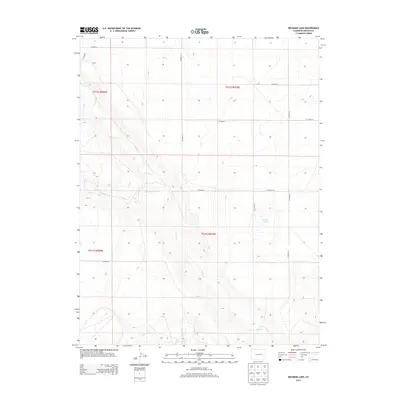
2013 Map of Beckman Lake
USGS Topo · Published 2013About this map
Beckman Lake lies at the center of this Lincoln County landscape, surrounded by a complex system of seasonal watercourses. The drainage network is defined by several branches of the same system, including N Rush Cr, Middle Rush Cr, and the primary Rush Cr which winds south toward S Rush Cr. The terrain is strictly partitioned by the Public Land Survey System, with the boundaries of t012s r055w and its neighboring townships clearly demarcated. A rigid grid of rural infrastructure, such as Co Road 30 and Co Road 2G, overlays the natural topography, illustrating the late-modern intersection of high-plains geography and organized county land management.
Find a feature on this map
18 named features on this map. Tap any name to fly to it.
Don’t see what you’re looking for? This feature index may not catch every label — zoom into the map to look around manually.
Map Details
Editions of this 2013 Beckman Lake Map
This is the sole edition of this map. No revisions or reprints were ever made.
Other maps of this area

1889 · Sanborn
USGS Topo · 1:125,000

1891 · Sanborn
USGS Topo · 1:125,000

1891 · Arroyo
USGS Topo · 1:125,000

1891 · Limon
USGS Topo · 1:125,000

1892 · Limon
USGS Topo · 1:125,000

1893 · Arroyo
USGS Topo · 1:125,000

1893 · Sanborn
USGS Topo · 1:125,000

1954 · Limon
USGS Topo · 1:250,000

1954 · Lamar
USGS Topo · 1:250,000

1957 · Limon
USGS Topo · 1:250,000