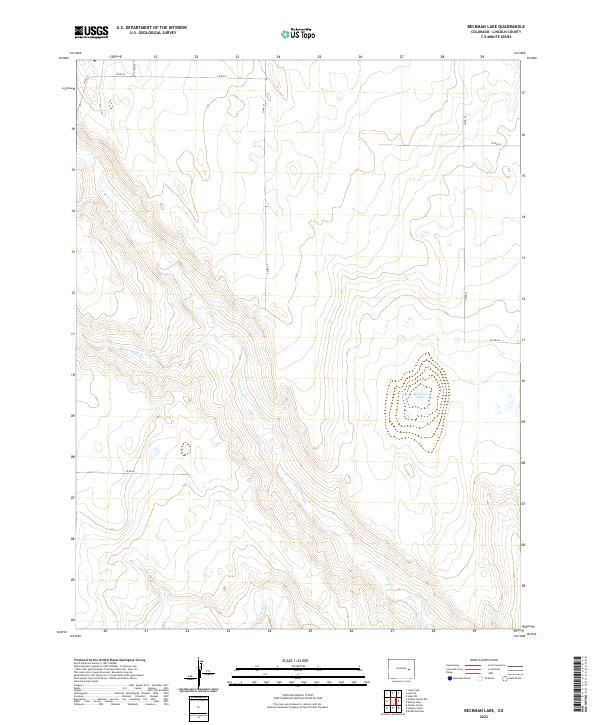
2022 Map of Beckman Lake
USGS Topo · Published 2022About this map
Rush Cr and its various branches dominate this portion of Lincoln County, defining a landscape shaped by intermittent drainage and the pastoral needs of the high plains. The terrain is notably sparse, with the watershed of N Rush Cr, Middle Rush Cr, and S Rush Cr converging as they move through the township boundaries of t13s r55w and t13s r56w. This 2022 survey captures the area’s reliance on a grid of county roads, such as Co RD 30 and Co RD 27, which provide the primary access to the isolated agricultural sections and water features like Beckman Lake. The absence of named settlements reflects the vast, open nature of this prairie region, where land management is dictated by section lines and the seasonal flow of the creeks.
Find a feature on this map
17 named features on this map. Tap any name to fly to it.
Don’t see what you’re looking for? This feature index may not catch every label — zoom into the map to look around manually.
Map Details
Editions of this 2022 Beckman Lake Map
This is the sole edition of this map. No revisions or reprints were ever made.
Other maps of this area

1889 · Sanborn
USGS Topo · 1:125,000

1891 · Sanborn
USGS Topo · 1:125,000

1891 · Arroyo
USGS Topo · 1:125,000

1891 · Limon
USGS Topo · 1:125,000

1892 · Limon
USGS Topo · 1:125,000

1893 · Arroyo
USGS Topo · 1:125,000

1893 · Sanborn
USGS Topo · 1:125,000

1954 · Limon
USGS Topo · 1:250,000

1954 · Lamar
USGS Topo · 1:250,000

1957 · Limon
USGS Topo · 1:250,000