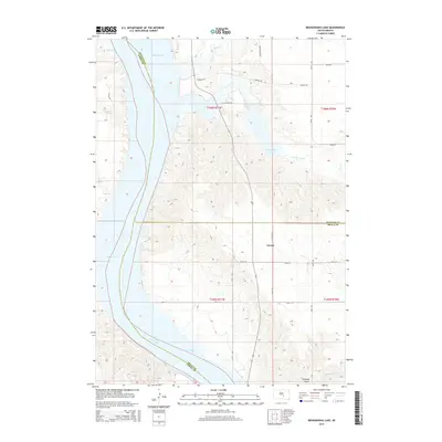
2015 Map of Bedashosha Lake
USGS Topo · Published 2015About this map
The Missouri River forms a major geographic corridor here at the convergence of Buffalo, Lyman, and Brule Counties. The landscape is defined by the expansive Lake Francis Case reservoir and the rugged draws that feed into the valley, such as Tischudy Gulch and the drainage of Bad Hand Cr. The small settlement of Grosse sits inland from the river, situated between the upland prairies and the complex network of creeks like Crow Creek and Wolf Cr.
Find a feature on this map
24 named features on this map. Tap any name to fly to it.
Don’t see what you’re looking for? This feature index may not catch every label — zoom into the map to look around manually.
Map Details
Editions of this 2015 Bedashosha Lake Map
This is the sole edition of this map. No revisions or reprints were ever made.
Other maps of this area

1935 · Chamberlain
USGS Topo · 1:62,500

1939 · Chamberlain
USGS Topo · 1:62,500

1941 · Pukwana
USGS Topo · 1:62,500

1951 · Pukwana
USGS Topo · 1:62,500

1952 · Oacoma
USGS Topo · 1:24,000

1953 · Huron
USGS Topo · 1:250,000

1954 · Huron
USGS Topo · 1:250,000

1955 · Mitchell
USGS Topo · 1:250,000

1959 · Mitchell
USGS Topo · 1:250,000

1966 · Big Bend Dam SE
USGS Topo · 1:24,000
Featured Places
- West Point Township, SD
- Wilson Township, Crow Creek District
- Grosse, SD
- Fort Thompson District, SD
- Crow Creek District, SD