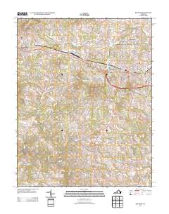
2013 Map of Bedford
USGS Topo · Published 2013About this map
Bedford serves as the central hub for this 2013 survey, where modern development meets the rolling foothills of the Blue Ridge. The landscape is defined by its drainage basins, with the Little Otter River and its various forks flowing eastward while Wolf Creek and Goose Creek snake through the western reaches. Suburban expansion is evident in neighborhoods like Northwood Heights and North Hills, yet the map preserves older site names and rural intersections like Five Forks and Bunker Hill. To the west, the topography rises sharply toward Cobbs Mountain and Mosely Mountain, where the street grid gives way to winding routes like Scenic Mountain Drive. Local landmarks such as the Bedford Lookout Tower and Robinson Airport anchor the transition between the developed town center and the outlying timbered ridges and agricultural tracts.
Find a feature on this map
177 named features on this map. Tap any name to fly to it.
Don’t see what you’re looking for? This feature index may not catch every label — zoom into the map to look around manually.
Map Details
Editions of this 2013 Bedford Map
This is the sole edition of this map. No revisions or reprints were ever made.
Other maps of this area

1890 · Roanoke
USGS Topo · 1:125,000

1891 · Roanoke
USGS Topo · 1:125,000

1892 · Lynchburg
USGS Topo · 1:125,000

1947 · Roanoke
USGS Topo · 1:250,000

1950 · Goode
USGS Topo · 1:62,500

1950 · Peaks of Otter
USGS Topo · 1:62,500

1951 · Moneta
USGS Topo · 1:62,500

1951 · Altavista
USGS Topo · 1:62,500

1959 · Roanoke
USGS Topo · 1:250,000

1963 · Roanoke
USGS Topo · 1:250,000