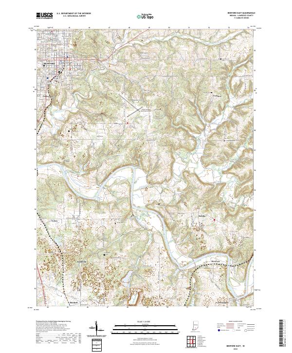
2022 Map of Bedford East
USGS Topo · Published 2022About this map
The Lawrence County Courthouse stands at the heart of Bedford, a city whose layout reflects its industrial and civic importance in southern Indiana. The landscape transitions from the urban density of Bedford south toward the Mitchell Plain, a physiographic region known for its distinct limestone topography. This area is deeply etched by the East Fork White River and its numerous tributaries, including Leatherwood Creek and Guthrie Creek, which define the local drainage patterns. Evidence of the region's historic limestone industry is found along Cement Plant Rd, signaling the economic drivers that shaped local growth.
Find a feature on this map
98 named features on this map. Tap any name to fly to it.
Don’t see what you’re looking for? This feature index may not catch every label — zoom into the map to look around manually.
Map Details
Editions of this 2022 Bedford East Map
This is the sole edition of this map. No revisions or reprints were ever made.
Other maps of this area

1934 · Bedford
USGS Topo · 1:48,000

1935 · Oolitic
USGS Topo · 1:48,000

1937 · Bedford
USGS Topo · 1:62,500

1942 · Oolitic
USGS Topo · 1:62,500

1949 · Georgia
USGS Topo · 1:24,000

1950 · Mitchell
USGS Topo · 1:24,000

1951 · Georgia
USGS Topo · 1:24,000

1956 · Vincennes
USGS Topo · 1:250,000

1957 · Vincennes
USGS Topo · 1:250,000
1957 · Oolitic
USGS Topo · 1:24,000