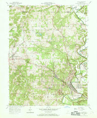
1957 Map of Oolitic
USGS Topo · Published 1958About this map
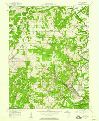
Oolitic sits at the heart of this mid-century Lawrence County landscape, defined by its limestone heritage and the deep drainage of Salt Creek. The map documents a complex industrial and agricultural environment, featuring numerous quarries particularly around Dark Hollow and East Oolitic. The winding route of the Monon railroad connects these stone-working sites to outlying settlements like Avoca and Logan. Beyond the industry, the survey shows significant institutional footprints, including the Purdue University Experimental Farm and the State Fish Hatchery near Avoca. Genealogists will find a dense network of family-named landmarks and burial grounds such as Anderson Cem, Brinegar Cem, and Judah Cem. The map captures the area just before significant modernization, showing a landscape still heavily partitioned by rural schools like Beard Sch and secluded gathering places like Camp Indi-Co-So.
Find a feature on this map
51 named features on this map. Tap any name to fly to it.
Don’t see what you’re looking for? This feature index may not catch every label — zoom into the map to look around manually.
Map Details
Editions of this 1957 Oolitic Map
2 editions found
Other maps of this area

1908 · Bloomington
USGS Topo · 1:48,000

1910 · Bloomington
USGS Topo · 1:62,500

1934 · Bedford
USGS Topo · 1:48,000

1935 · Oolitic
USGS Topo · 1:48,000

1937 · Bedford
USGS Topo · 1:62,500

1942 · Franklin
USGS Topo · 1:125,000

1942 · Oolitic
USGS Topo · 1:62,500

1947 · Allens Creek
USGS Topo · 1:24,000

1953 · Indianapolis
USGS Topo · 1:250,000

1956 · Indianapolis
USGS Topo · 1:250,000