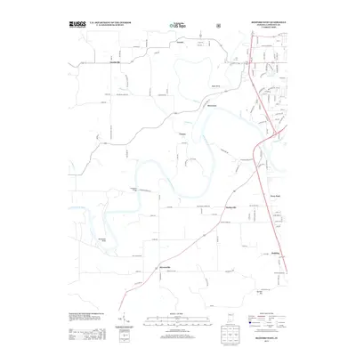
2013 Map of Bedford West
USGS Topo · Published 2013About this map
The E Fork White River carves a winding path through this corner of Lawrence County, creating prominent landforms like Gyger Bend and Horseshoe Bend. The landscape is a mix of small rural communities and significant water crossings, anchored by the Stumphole Bridge. To the north and west, settlements such as Eureka and Fayetteville sit amidst a network of country lanes, while the eastern edge transition toward the residential outskirts of the county seat. This 2013 survey illustrates the local importance of naming even minor drainage features, with Adamson Br and Spider Cr etched into the topography. Along the southern corridor near Rariden Hill, the presence of the Mitchell Speedway highlights the recreational and social hubs that persist in this part of southern Indiana, alongside older hamlets like Bryantsville and Coxton.
Find a feature on this map
111 named features on this map. Tap any name to fly to it.
Don’t see what you’re looking for? This feature index may not catch every label — zoom into the map to look around manually.
Map Details
Editions of this 2013 Bedford West Map
This is the sole edition of this map. No revisions or reprints were ever made.
Other maps of this area

1934 · Bedford
USGS Topo · 1:48,000

1935 · Oolitic
USGS Topo · 1:48,000

1937 · Bedford
USGS Topo · 1:62,500

1942 · Oolitic
USGS Topo · 1:62,500

1948 · Huron
USGS Topo · 1:24,000

1949 · Georgia
USGS Topo · 1:24,000

1950 · Mitchell
USGS Topo · 1:24,000

1950 · Huron
USGS Topo · 1:24,000

1951 · Georgia
USGS Topo · 1:24,000

1956 · Vincennes
USGS Topo · 1:250,000