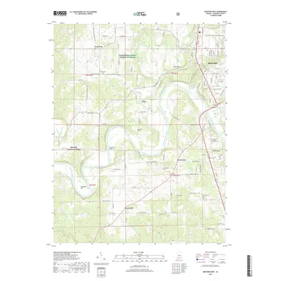
2019 Map of Bedford West
USGS Topo · Published 2019About this map
The East Fork White River anchors this Lawrence County landscape, carving through the Mitchell Plain and forming dramatic features like Horseshoe Bend and Gyger Bend. This modern survey illustrates the suburban expansion of Bedford south and west, where residential developments like Tarry Park meet the established rural character of Fayetteville and Bryantsville. The area is notably dense with family and community burial grounds, including Old Union Cem, Cox Cem, and Knott Cem, which serve as vital markers for genealogical research.
Find a feature on this map
112 named features on this map. Tap any name to fly to it.
Don’t see what you’re looking for? This feature index may not catch every label — zoom into the map to look around manually.
Map Details
Editions of this 2019 Bedford West Map
This is the sole edition of this map. No revisions or reprints were ever made.
Other maps of this area

1934 · Bedford
USGS Topo · 1:48,000

1935 · Oolitic
USGS Topo · 1:48,000

1937 · Bedford
USGS Topo · 1:62,500

1942 · Oolitic
USGS Topo · 1:62,500

1948 · Huron
USGS Topo · 1:24,000

1949 · Georgia
USGS Topo · 1:24,000

1950 · Mitchell
USGS Topo · 1:24,000

1950 · Huron
USGS Topo · 1:24,000

1951 · Georgia
USGS Topo · 1:24,000

1956 · Vincennes
USGS Topo · 1:250,000