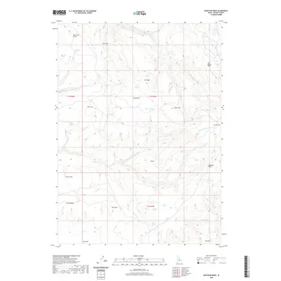
2020 Map of Bedstead Ridge
USGS Topo · Published 2020About this map
Middle Fork Owyhee River carves through this high-desert plateau of Owyhee County, defining a landscape of broad flats and dramatic breaks. This 2020 survey reveals an area largely shaped by its hydrology, with numerous named water sources such as C C C Spring, Two Springs, and Fenwick Spring supporting life across the arid terrain. The map details the expansive Manada Flat and Stauffer Flat, while topographical landmarks like Juniper Mtn and The Buttes provide vertical orientation. Named cattle-country features like Dukes Hole and Herds V suggest the region's enduring ranching history, while Pole Creek Breaks illustrates the sharp transitions between the level flats and the deeply incised drainages of Squaw Cr and Pole Cr. This documentation captures the character of Idaho's southwestern corner, where the network of springs and creeks remains the primary driver of geography.
Find a feature on this map
49 named features on this map. Tap any name to fly to it.
Don’t see what you’re looking for? This feature index may not catch every label — zoom into the map to look around manually.
Map Details
Editions of this 2020 Bedstead Ridge Map
This is the sole edition of this map. No revisions or reprints were ever made.
Other maps of this area

1955 · Jordan Valley
USGS Topo · 1:250,000

1957 · Jordan Valley
USGS Topo · 1:250,000

1958 · Jordan Valley
USGS Topo · 1:250,000

1973 · Red Basin
USGS Topo · 1:24,000

1973 · Smith Creek
USGS Topo · 1:24,000

1973 · Bedstead Ridge
USGS Topo · 1:24,000

1973 · Pleasant Valley
USGS Topo · 1:24,000

1973 · Fairylawn
USGS Topo · 1:24,000
1977 · Bull Basin Camp
USGS Topo · 1:24,000

1980 · Brewster Reservoir
USGS Topo · 1:24,000