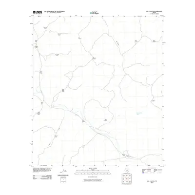
2010 Map of Bee Canyon
USGS Topo · Published 2010About this map
The arid landscape of Val Verde County is defined by an intricate network of seasonal drainage channels and isolated ranching outposts. This 2010 survey highlights the importance of water infrastructure in West Texas, where numerous windmills such as the High Lonesome Windmill and Double Gates Windmill are vital markers on the terrain. Transport in this region is anchored by the presence of Juno Rd W, which follows the natural contours of the land toward the southeast.
Find a feature on this map
33 named features on this map. Tap any name to fly to it.
Don’t see what you’re looking for? This feature index may not catch every label — zoom into the map to look around manually.
Map Details
Editions of this 2010 Bee Canyon Map
This is the sole edition of this map. No revisions or reprints were ever made.
Other maps of this area

1954 · Sonora
USGS Topo · 1:250,000

1958 · Sonora
USGS Topo · 1:250,000

1970 · Aermotor Draw
USGS Topo · 1:24,000

1970 · Juno
USGS Topo · 1:24,000

1970 · Steel Star Draw
USGS Topo · 1:24,000

1970 · Indian Draw
USGS Topo · 1:24,000

1970 · Sycamore Canyon
USGS Topo · 1:24,000

1970 · Blue Hills
USGS Topo · 1:24,000

1970 · Bee Canyon
USGS Topo · 1:24,000

1970 · Brushy Draw
USGS Topo · 1:24,000