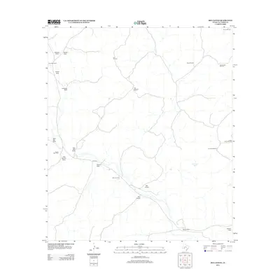
2012 Map of Bee Canyon
USGS Topo · Published 2012About this map
The arid ranching landscape of Val Verde County is defined by a complex network of seasonal watercourses and remote livestock infrastructure. Large landholdings like the Wayne West Ranch, Massie West Ranch, and Mayfield Ranch anchor the territory, connected by the unpaved corridor of Juno Rd W. This 2012 survey illustrates the vital importance of water management in West Texas, evidenced by the numerous named draws—such as Edwards Draw, Leonedas Draw, and Duncan Draw—that channel infrequent rainfall toward Bee Canyon and Mud Canyon.
Find a feature on this map
25 named features on this map. Tap any name to fly to it.
Don’t see what you’re looking for? This feature index may not catch every label — zoom into the map to look around manually.
Map Details
Editions of this 2012 Bee Canyon Map
This is the sole edition of this map. No revisions or reprints were ever made.
Other maps of this area

1954 · Sonora
USGS Topo · 1:250,000

1958 · Sonora
USGS Topo · 1:250,000

1970 · Aermotor Draw
USGS Topo · 1:24,000

1970 · Juno
USGS Topo · 1:24,000

1970 · Steel Star Draw
USGS Topo · 1:24,000

1970 · Indian Draw
USGS Topo · 1:24,000

1970 · Sycamore Canyon
USGS Topo · 1:24,000

1970 · Blue Hills
USGS Topo · 1:24,000

1970 · Bee Canyon
USGS Topo · 1:24,000

1970 · Brushy Draw
USGS Topo · 1:24,000