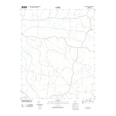
2010 Map of Beech Bluff
USGS Topo · Published 2010About this map
The North Fork Forked Deer River and South Fork Forked Deer River define the hydraulic character of this Tennessee landscape. This 2010 survey shows a network of named country roads and rural routes connecting scattered residences and family landholdings. Centered around the Beech Bluff Post Office, the community layout is shaped by numerous tributaries including Marlin Creek, Finger Creek, and Moore Branch. The presence of the Tennessee Sheriffs Youthtown Lake in the southwest corner and long-established thoroughfares like Harts Bridge Rd and Potts Chapel Rd reflect a region where modern institutional use meets traditional agricultural settlement patterns. For the genealogist, family-named landmarks like John Brown Rd, Ed Moore Rd, and Leeper Ln provide specific geographic anchors for tracing local heritage.
Find a feature on this map
46 named features on this map. Tap any name to fly to it.
Don’t see what you’re looking for? This feature index may not catch every label — zoom into the map to look around manually.
Map Details
Editions of this 2010 Beech Bluff Map
This is the sole edition of this map. No revisions or reprints were ever made.
Other maps of this area

1950 · Jackson South
USGS Topo · 1:24,000

1950 · Jackson North
USGS Topo · 1:24,000

1951 · Jackson North
USGS Topo · 1:24,000

1953 · Claybrook
USGS Topo · 1:24,000

1953 · Beech Bluff
USGS Topo · 1:24,000

1955 · Luray
USGS Topo · 1:24,000

1955 · Juno
USGS Topo · 1:24,000

1956 · Blytheville
USGS Topo · 1:250,000

1959 · Blytheville
USGS Topo · 1:250,000

1961 · Medon
USGS Topo · 1:24,000