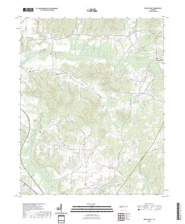
2022 Map of Beech Bluff
USGS Topo · Published 2022About this map
The North Fork Forked Deer River and its southern counterpart define the undulating geography of this Madison County landscape, where the settlement of Beech Bluff sits along the northeastern edge. The terrain is a network of small creeks and branches, including Marlin Cr, Bear Cr, and Hunters Cr, which carve through the rural countryside. Near the boundary of Madison and Chester counties, smaller communities like Maple Grove and Five Points serve as local hubs connected by a dense grid of named roads such as Mifflin Rd and Beech Bluff Rd. To the southwest, the Tennessee Sheriffs Youthtown Lake and the adjacent Youthtown Lake represent significant modern landmarks. The map illustrates a contemporary rural Tennessee environment where traditional agricultural land patterns persist alongside established family-named roads and natural drainage systems that have shaped local property lines for generations.
Find a feature on this map
77 named features on this map. Tap any name to fly to it.
Don’t see what you’re looking for? This feature index may not catch every label — zoom into the map to look around manually.
Map Details
Editions of this 2022 Beech Bluff Map
This is the sole edition of this map. No revisions or reprints were ever made.
Other maps of this area

1950 · Jackson South
USGS Topo · 1:24,000

1950 · Jackson North
USGS Topo · 1:24,000

1951 · Jackson North
USGS Topo · 1:24,000

1953 · Claybrook
USGS Topo · 1:24,000

1953 · Beech Bluff
USGS Topo · 1:24,000

1955 · Luray
USGS Topo · 1:24,000

1955 · Juno
USGS Topo · 1:24,000

1956 · Blytheville
USGS Topo · 1:250,000

1959 · Blytheville
USGS Topo · 1:250,000

1961 · Medon
USGS Topo · 1:24,000