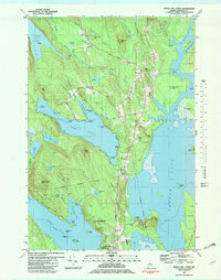
1981 Map of Beech Hill Pond
USGS Topo · Published 1982About this map
Beech Hill Pond and the surrounding glacial highlands of Hancock County define this 1981 survey. The landscape is characterized by its complex hydrology, where Floods Pond and the West Branch Union River frame the settlements of Otis and Mariaville. A rural economy is visible through the concentration of gravel pits and the presence of the Green Lake National Fish Hatchery at the southern margin. Notable local landmarks include the Beech Hill Sch, the Greenwood Cem, and several named points such as Grotto Hill and Salisbury Point. The map provides a detailed view of the era's transport, featuring a small Landing Field near Ellsworth and the Town Landing on the Union River, reflecting the region's reliance on both aviation and waterways during the early 1980s.
Find a feature on this map
87 named features on this map. Tap any name to fly to it.
Don’t see what you’re looking for? This feature index may not catch every label — zoom into the map to look around manually.
Map Details
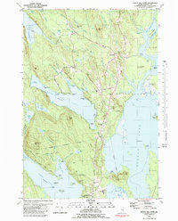
Editions of this 1981 Beech Hill Pond Map
2 editions found
Other maps of this area

1900 · Orland
USGS Topo · 1:62,500

1902 · Orono
USGS Topo · 1:62,500

1911 · Ellsworth
USGS Topo · 1:62,500

1929 · Great Pond
USGS Topo · 1:48,000

1932 · Great Pond
USGS Topo · 1:62,500

1940 · Ellsworth
USGS Topo · 1:62,500

1942 · Orland
USGS Topo · 1:62,500

1942 · Ellsworth
USGS Topo · 1:62,500

1944 · Orono
USGS Topo · 1:62,500

1946 · Orono
USGS Topo · 1:62,500