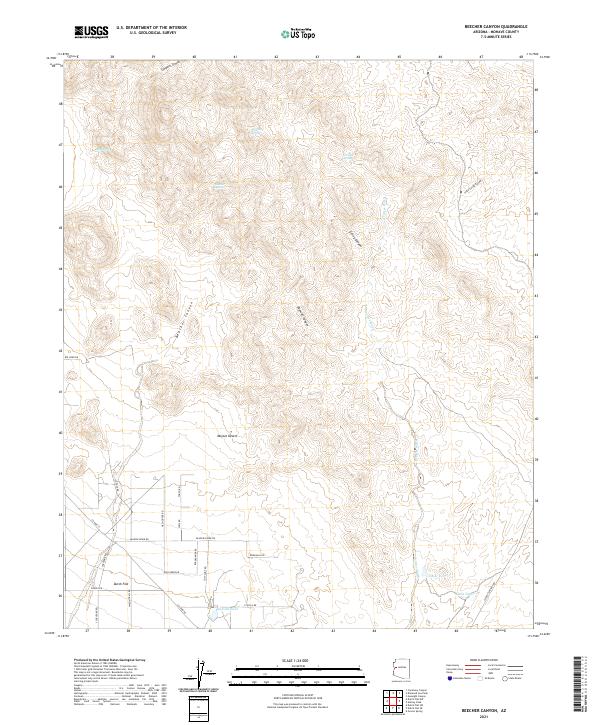
2021 Map of Beecher Canyon
USGS Topo · Published 2021About this map
The arid landscape of the Mojave Desert in Mohave County is defined here by a network of seasonal washes and isolated water sources essential for desert survival. Water management is evident through features like Crozier Tank, Little Tank, and Roadside Tank, which supported cattle ranching and travel in this corner of Arizona. The settlement of Dutch Flat sits in the southwestern portion of the sheet, served by a grid of local roads including Wagon Trail Rd and Cheyenne Rd.
Find a feature on this map
39 named features on this map. Tap any name to fly to it.
Don’t see what you’re looking for? This feature index may not catch every label — zoom into the map to look around manually.
Map Details
Editions of this 2021 Beecher Canyon Map
This is the sole edition of this map. No revisions or reprints were ever made.
Other maps of this area

1923 · Signal
USGS Topo · 1:250,000

1942 · Signal
USGS Topo · 1:250,000

1950 · Prescott
USGS Topo · 1:250,000

1954 · Prescott
USGS Topo · 1:250,000

1958 · Prescott
USGS Topo · 1:250,000

1959 · Prescott
USGS Topo · 1:250,000

1960 · Prescott
USGS Topo · 1:250,000

1965 · Prescott
USGS Topo · 1:250,000
1967 · Groom Spring
USGS Topo · 1:24,000
1967 · Dutch Flat SE
USGS Topo · 1:24,000