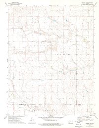
1974 Map of Beeler SE
USGS Topo · Published 1976About this map
Manteno Community Hall stands as a focal point for the rural townships of Johnson and Franklin during the mid-1970s. This High Plains landscape is defined by the drainage of the South Fork and the deeply incised Guzzlers Gulch, which cut through the high western Kansas tablelands. The map reveals a transition toward more industrial land use, marked by several scattered Oil Wells and a Gravel Pit positioned near the local waterways. The southern reaches of the survey cross the Ness Co Hodgeman Co boundary into Roscoe township, following the course of Plum Creek. This document preserves the location of a small Cem and the settlement at Monroe, providing a detailed view of the section-line road network and early energy development in the region.
Find a feature on this map
14 named features on this map. Tap any name to fly to it.
Don’t see what you’re looking for? This feature index may not catch every label — zoom into the map to look around manually.
Map Details
Editions of this 1974 Beeler SE Map
This is the sole edition of this map. No revisions or reprints were ever made.
Other maps of this area

1892 · Ness
USGS Topo · 1:125,000

1894 · Ness
USGS Topo · 1:125,000

1955 · Great Bend
USGS Topo · 1:250,000

1955 · Scott City
USGS Topo · 1:250,000

1957 · Great Bend
USGS Topo · 1:250,000

1958 · Great Bend
USGS Topo · 1:250,000

1958 · Scott City
USGS Topo · 1:250,000

1965 · Beeler
USGS Topo · 1:24,000

1966 · Ness City
USGS Topo · 1:24,000

1966 · Laird
USGS Topo · 1:24,000