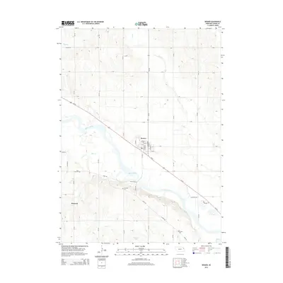
2014 Map of Beemer
USGS Topo · Published 2014About this map
The Elkhorn River meanders across this Cuming County landscape, anchoring the settlement of Beemer and the surrounding agricultural plains. This survey documents the intersection of modern transportation via Us-275 with older geographic markers, including the smaller community of Bismarck to the southwest. The grid of rural routes like Indian Trail Rd and River Rd connects several significant local burial sites, providing essential data for genealogical research at Beemer Cem, Rock Creek Cem, Immanuel Cem, and Greenwood Cem. Tributaries such as Plum Cr, Rock Cr, and Fisher Cr define the local drainage patterns, while the presence of Dry Ditch in the northwest corner suggests managed irrigation or drainage efforts common to Nebraska's farming history.
Find a feature on this map
45 named features on this map. Tap any name to fly to it.
Don’t see what you’re looking for? This feature index may not catch every label — zoom into the map to look around manually.
Map Details
Editions of this 2014 Beemer Map
This is the sole edition of this map. No revisions or reprints were ever made.
Other maps of this area

1955 · Sioux City
USGS Topo · 1:250,000

1955 · Fremont
USGS Topo · 1:250,000

1957 · Fremont
USGS Topo · 1:250,000

1958 · Sioux City
USGS Topo · 1:250,000

1958 · Fremont
USGS Topo · 1:250,000

1959 · Sioux City
USGS Topo · 1:250,000

1963 · Wisner
USGS Topo · 1:24,000

1963 · Altona
USGS Topo · 1:24,000

1966 · West Point NW
USGS Topo · 1:24,000

1966 · Monterey
USGS Topo · 1:24,000