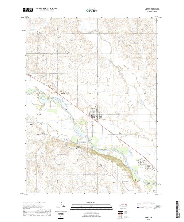
2021 Map of Beemer
USGS Topo · Published 2021About this map
The village of Beemer serves as the central hub of this Cuming County landscape, situated where the high plains meet the winding valley of the Elkhorn River. The river's broad floodplain is marked by numerous seasonal wetlands and oxbows, with the Upper Elkhorn River Trl tracing the northern bank. This 2021 survey reveals a deeply rooted rural community, evidenced by several well-maintained burial grounds including Beemer Cem, Rock Creek Cem, and Greenwood Cem.
Find a feature on this map
27 named features on this map. Tap any name to fly to it.
Don’t see what you’re looking for? This feature index may not catch every label — zoom into the map to look around manually.
Map Details
Editions of this 2021 Beemer Map
This is the sole edition of this map. No revisions or reprints were ever made.
Other maps of this area

1955 · Sioux City
USGS Topo · 1:250,000

1955 · Fremont
USGS Topo · 1:250,000

1957 · Fremont
USGS Topo · 1:250,000

1958 · Sioux City
USGS Topo · 1:250,000

1958 · Fremont
USGS Topo · 1:250,000

1959 · Sioux City
USGS Topo · 1:250,000

1963 · Wisner
USGS Topo · 1:24,000

1963 · Altona
USGS Topo · 1:24,000

1966 · West Point NW
USGS Topo · 1:24,000

1966 · Monterey
USGS Topo · 1:24,000