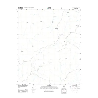
2012 Map of Behm Mesa
USGS Topo · Published 2012About this map
Behm Mesa and its surrounding high plateaus define this corner of Yavapai County, where water resources are captured in a series of remote tanks and springs. Cattle ranching and land management infrastructure are evident through features like Hardy-Schell Tank, Stubbs Tank, and the Lower Corral Tanks. The terrain is deeply incised by drainages such as Wilder Cr and Boulder Cr, creating natural basins including Silent Basin and Wildhorse Basin. Access to these uplands is provided by primitive routes like Camp Wood Rd and Behm Mesa Rd. This 2012 survey illustrates a landscape primarily shaped by topographical relief and the essential need for water catchment, from Pine Flat in the north to Blue Mountain at the southern edge.
Find a feature on this map
30 named features on this map. Tap any name to fly to it.
Don’t see what you’re looking for? This feature index may not catch every label — zoom into the map to look around manually.
Map Details
Editions of this 2012 Behm Mesa Map
This is the sole edition of this map. No revisions or reprints were ever made.
Other maps of this area

1887 · Prescott
USGS Topo · 1:250,000

1892 · Prescott
USGS Topo · 1:250,000

1923 · Signal
USGS Topo · 1:250,000

1942 · Signal
USGS Topo · 1:250,000

1945 · Bagdad
USGS Topo · 1:62,500

1947 · Sheridan Mountain
USGS Topo · 1:62,500

1947 · Camp Wood
USGS Topo · 1:62,500

1948 · Sheridan Mountain
USGS Topo · 1:63,360

1948 · Camp Wood
USGS Topo · 1:63,360

1948 · Bagdad
USGS Topo · 1:62,500