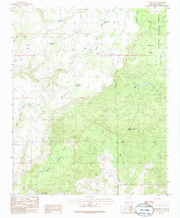
1986 Map of Behm Mesa
USGS Topo · Published 1986About this map
Behm Mesa and its surrounding plateaus define this corner of the Prescott National Forest in the mid-1980s. The landscape is characterized by a complex network of high mesas and deep drainage basins, including the notably named Silent Basin and Strotjost Flat. Resource management in this arid environment is evident through numerous water catchments like the Hardy-Schell Tank, Windy Ridge Tank, and Behm Mesa Tank, which support both local wildlife and grazing. Traces of historical prospecting appear near Loco Creek, where a Mine Tailings Shaft and other mine shafts are marked. The terrain transitions from the heights of Cypress Mountain down through the winding courses of Wildhorse Creek and Big Shipp Wash, illustrating the geologic character of the Yavapai back country during this period of provisional mapping.
Find a feature on this map
25 named features on this map. Tap any name to fly to it.
Don’t see what you’re looking for? This feature index may not catch every label — zoom into the map to look around manually.
Map Details
Editions of this 1986 Behm Mesa Map
This is the sole edition of this map. No revisions or reprints were ever made.
Other maps of this area

1887 · Prescott
USGS Topo · 1:250,000

1892 · Prescott
USGS Topo · 1:250,000

1923 · Signal
USGS Topo · 1:250,000

1942 · Signal
USGS Topo · 1:250,000

1945 · Bagdad
USGS Topo · 1:62,500

1947 · Sheridan Mountain
USGS Topo · 1:62,500

1947 · Camp Wood
USGS Topo · 1:62,500

1948 · Sheridan Mountain
USGS Topo · 1:63,360

1948 · Camp Wood
USGS Topo · 1:63,360

1948 · Bagdad
USGS Topo · 1:62,500