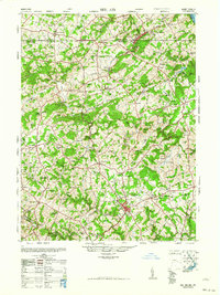
1963 Map of Belair
USGS Topo · Published 1963About this map
The Maryland and Pennsylvania RR threads through this 1948 topographic landscape, connecting rural communities across the state line between Harford County and York County. The survey captures a moment when the regional economy was transitioning, noting industrial remnants like the Talc (Abandoned) and Flint (Abandoned) mines near Delta. The seat of local government is anchored by the County Court House in Bel Air, while the surrounding countryside is densely populated with small parish centers and schools, such as William Watters Church and the Susquehanna Hall School. Waterways like Deer Creek and Broad Creek define the drainage toward the Susquehanna River, which forms the eastern boundary. This era shows a landscape still defined by its agrarian roots and rail-based transport, evidenced by local landmarks like the Race track and numerous rural cemeteries like Slate Ridge Cem.
Find a feature on this map
126 named features on this map. Tap any name to fly to it.
Don’t see what you’re looking for? This feature index may not catch every label — zoom into the map to look around manually.
Map Details
Editions of this 1963 Belair Map
This is the sole edition of this map. No revisions or reprints were ever made.
Other maps of this area

1893 · Gunpowder
USGS Topo · 1:62,500

1894 · Baltimore
USGS Topo · 1:62,500

1898 · Tolchester
USGS Topo · 1:125,000

1899 · Baltimore
USGS Topo · 1:62,500

1900 · Havre De Grace
USGS Topo · 1:62,500

1900 · Betterton
USGS Topo · 1:62,500

1900 · Parkton
USGS Topo · 1:62,500

1901 · Belair
USGS Topo · 1:62,500

1901 · Gunpowder
USGS Topo · 1:62,500

1902 · Parkton
USGS Topo · 1:62,500