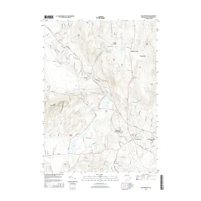
2015 Map of Belchertown
USGS Topo · Published 2015About this map
Belchertown and its surrounding countryside are defined by a complex network of brooks and ponds, reflecting the glacial topography of Hampshire County. The landscape features notable water bodies such as Metacomet Lake, Arcadia Lake, and Lake Holland, which are central to the area's geography. Historically established hamlets and crossroads like Dwight, Packardville, and Cooks Corner anchor the residential patterns, while several family-named burial grounds, including Munsell Cem and Lake Vale Cem, provide significant touchpoints for genealogical research. The New England National Scenic Trail traverses the terrain, crossing the Mount Holyoke Range and passing through Holland Glen. This survey captures the region's balance of residential development, such as Highland Glen Estates, and protected natural features like Long Mtn and Mt Lincoln.
Find a feature on this map
146 named features on this map. Tap any name to fly to it.
Don’t see what you’re looking for? This feature index may not catch every label — zoom into the map to look around manually.
Map Details
Editions of this 2015 Belchertown Map
This is the sole edition of this map. No revisions or reprints were ever made.
Other maps of this area

1885 · Northampton
USGS Topo · 1:62,500

1886 · Springfield
USGS Topo · 1:62,500

1886 · Northampton
USGS Topo · 1:62,500

1887 · Palmer
USGS Topo · 1:62,500

1887 · Belchertown
USGS Topo · 1:62,500

1889 · Springfield
USGS Topo · 1:62,500

1889 · Palmer
USGS Topo · 1:62,500

1890 · Belchertown
USGS Topo · 1:62,500

1891 · Northampton
USGS Topo · 1:62,500

1893 · Northampton
USGS Topo · 1:62,500