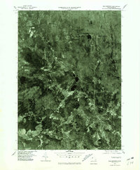
1975 Map of Belchertown
USGS Topo · Published 1981About this map
Belchertown and its surrounding crossroads communities are captured in this mid-1970s orthophotoquad, which uses rectified aerial imagery to show the landscape of Hampshire County in detail. The settlement pattern is anchored by the village center and a series of distinct corners, including Meads Corner and Knights Corner to the north, and Cooks Corner to the west. This format provides a clear view of the land use during this era, where residential clusters are interspersed with dense woodlands and agricultural clearings. The western portion of the map is dominated by the broad expanse of Lawrence Swamp, while the small community of Dwight sits along the rail line that bisects the terrain. This photographic record allows for a direct comparison of modern property boundaries and forest cover against the historic footprint of these central Massachusetts towns.
Find a feature on this map
6 named features on this map. Tap any name to fly to it.
Don’t see what you’re looking for? This feature index may not catch every label — zoom into the map to look around manually.
Map Details
Editions of this 1975 Belchertown Map
This is the sole edition of this map. No revisions or reprints were ever made.
Other maps of this area

1885 · Northampton
USGS Topo · 1:62,500

1886 · Springfield
USGS Topo · 1:62,500

1886 · Northampton
USGS Topo · 1:62,500

1887 · Palmer
USGS Topo · 1:62,500

1887 · Belchertown
USGS Topo · 1:62,500

1889 · Springfield
USGS Topo · 1:62,500

1889 · Palmer
USGS Topo · 1:62,500

1890 · Belchertown
USGS Topo · 1:62,500

1891 · Northampton
USGS Topo · 1:62,500

1893 · Northampton
USGS Topo · 1:62,500