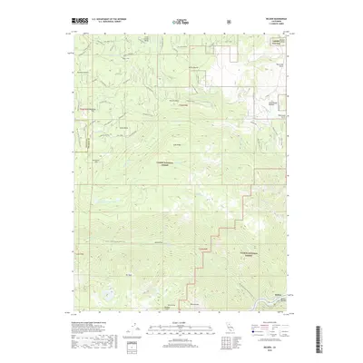
2018 Map of Belden
USGS Topo · Published 2018About this map
The North Fork Feather River carves through the southeastern corner of this terrain, marking a dramatic transition between the high forest ridges and the deep canyon floor. Located at the intersection of Butte Co and Plumas Co, this area is defined by the high-elevation wilderness of Lassen National Forest and Plumas National Forest. The map documents a complex network of forest spurs and flats, including Milkhouse Flat and Sunflower Flat, which speak to the historical grazing and timber access in these uplands. Prominent geological landmarks like Castle Rocks and Ben Lomond rise above the drainage systems of Yellow Creek and Chips Cr. The Pacific Crest National Scenic Trail winds through the center of the sheet, connecting alpine water bodies such as Green Island Lake and Saucer Lake with the remote outpost of Belden along the riverbanks.
Find a feature on this map
67 named features on this map. Tap any name to fly to it.
Don’t see what you’re looking for? This feature index may not catch every label — zoom into the map to look around manually.
Map Details
Editions of this 2018 Belden Map
This is the sole edition of this map. No revisions or reprints were ever made.
Other maps of this area

1886 · Lassen Peak
USGS Topo · 1:250,000

1888 · Bidwell Bar
USGS Topo · 1:125,000

1891 · Bidwell Bar
USGS Topo · 1:125,000

1892 · Lassen Peak
USGS Topo · 1:250,000

1893 · Bidwell Bar
USGS Topo · 1:125,000

1894 · Lassen Peak
USGS Topo · 1:250,000

1895 · Bidwell Bar
USGS Topo · 1:125,000

1897 · Bidwell Bar
USGS Topo · 1:125,000

1950 · Bucks Lake
USGS Topo · 1:62,500

1955 · Almanor
USGS Topo · 1:62,500