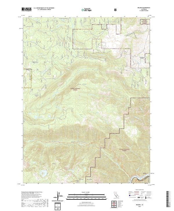
2021 Map of Belden
USGS Topo · Published 2021About this map
Belden sits at the confluence of the North Fork Feather River and Belden Ravine, marking a point of transition between the Lassen National Forest and Plumas National Forest. This high-altitude landscape is defined by its complex drainage systems, where Chips Cr and Yellow Cr feed into the river valley. The presence of the Pacific Crest National Scenic Trl cutting through the center of the sheet highlights the area's significance for long-distance wilderness travel, passing landmarks like Myrtle Flat and the slopes of Mt Hope. High mountain meadows and flats, such as Milkhouse Flat and Sunflower Flat, dot the higher elevations near Little Grizzly Valley, providing a record of the region's diverse topographical features. Historical travel routes like Humbug Road connect these remote basins, linking points such as Soda Spring and Chips Lake.
Find a feature on this map
53 named features on this map. Tap any name to fly to it.
Don’t see what you’re looking for? This feature index may not catch every label — zoom into the map to look around manually.
Map Details
Editions of this 2021 Belden Map
This is the sole edition of this map. No revisions or reprints were ever made.
Other maps of this area

1886 · Lassen Peak
USGS Topo · 1:250,000

1888 · Bidwell Bar
USGS Topo · 1:125,000

1891 · Bidwell Bar
USGS Topo · 1:125,000

1892 · Lassen Peak
USGS Topo · 1:250,000

1893 · Bidwell Bar
USGS Topo · 1:125,000

1894 · Lassen Peak
USGS Topo · 1:250,000

1895 · Bidwell Bar
USGS Topo · 1:125,000

1897 · Bidwell Bar
USGS Topo · 1:125,000

1950 · Bucks Lake
USGS Topo · 1:62,500

1955 · Almanor
USGS Topo · 1:62,500