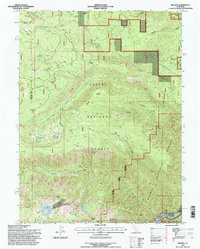
1995 Map of Belden
USGS Topo · Published 1997About this map
The North Fork Feather River carves through the southern corner of this landscape, marking the site of Belden and the nearby Morris Mine. This mid-1990s U.S. Forest Service and USGS collaboration captures a wilderness in transition, where the Pacific Crest National Scenic Trail winds across high flats like Myrtle Flat and Sunflower Flat. The terrain is defined by dramatic elevation changes, from the depths of Miller Ravine to the heights of Mount Hope and Ben Lomond.
Find a feature on this map
54 named features on this map. Tap any name to fly to it.
Don’t see what you’re looking for? This feature index may not catch every label — zoom into the map to look around manually.
Map Details
Editions of this 1995 Belden Map
This is the sole edition of this map. No revisions or reprints were ever made.
Other maps of this area

1886 · Lassen Peak
USGS Topo · 1:250,000

1888 · Bidwell Bar
USGS Topo · 1:125,000

1891 · Bidwell Bar
USGS Topo · 1:125,000

1892 · Lassen Peak
USGS Topo · 1:250,000

1893 · Bidwell Bar
USGS Topo · 1:125,000

1894 · Lassen Peak
USGS Topo · 1:250,000

1895 · Bidwell Bar
USGS Topo · 1:125,000

1897 · Bidwell Bar
USGS Topo · 1:125,000

1950 · Bucks Lake
USGS Topo · 1:62,500

1955 · Almanor
USGS Topo · 1:62,500