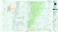
1979 Map of Belen
USGS Topo · Published 1979About this map
Isleta Pueblo and the surrounding river valley dominate this late-1970s landscape, where the Rio Grande creates a green ribbon of agriculture and settlement through the high desert. The map captures the distinct Subdivision Tome Road Pattern and the sprawling Rio Grande Estates, illustrating the transition from traditional land grants like Nicolas Duran de Chavez to modern residential planning. To the east, the sharp rise of the Cibola National Forest divides the valley from the high plains of Estancia and Moriarty.
Find a feature on this map
139 named features on this map. Tap any name to fly to it.
Don’t see what you’re looking for? This feature index may not catch every label — zoom into the map to look around manually.
Map Details
Editions of this 1979 Belen Map
2 editions found
Other maps of this area

1883 · Mt. Taylor
USGS Topo · 1:250,000

1886 · Mt. Taylor
USGS Topo · 1:250,000

1888 · Bernalillo
USGS Topo · 1:125,000

1889 · Albuquerque
USGS Topo · 1:125,000

1892 · San Pedro
USGS Topo · 1:125,000

1892 · Mt. Taylor
USGS Topo · 1:250,000

1893 · Albuquerque
USGS Topo · 1:125,000

1894 · Lamy
USGS Topo · 1:125,000

1899 · Mt. Taylor
USGS Topo · 1:250,000

1916 · La Joya
USGS Topo · 1:125,000