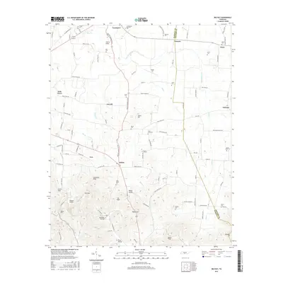
2016 Map of Belfast
USGS Topo · Published 2016About this map
Belfast and Farmington anchor this rural landscape in Marshall and Bedford counties, where the terrain transitions from the rolling lowlands of Liberty Valley into the more prominent elevations of the Highland Rim. The northern portion of the map features the Confederate Memorial Park and several small, family-named burial grounds like Bills Cem and Erwin Cem, which serve as vital markers for local genealogical research. In the southwest, the topography becomes more complex near Grandview Ridge and Bagley Gap, where a network of hollows—including Polecat Hollow and Petty Hollow—drain into Richland Cr. This 2016 survey documents a traditional Tennessee agricultural environment characterized by dispersed settlements such as Palmetto and Wheel, connected by historical routes like the Belfast Farmington Rd and Old Farmington Rd. The inclusion of Hudgin Air reflects modern land use amidst these long-standing farming communities.
Find a feature on this map
114 named features on this map. Tap any name to fly to it.
Don’t see what you’re looking for? This feature index may not catch every label — zoom into the map to look around manually.
Map Details
Editions of this 2016 Belfast Map
This is the sole edition of this map. No revisions or reprints were ever made.
Other maps of this area

1936 · Farmington
USGS Topo · 1:24,000

1936 · Belfast
USGS Topo · 1:24,000

1936 · Cornersville
USGS Topo · 1:24,000

1936 · Lewisburg
USGS Topo · 1:24,000

1936 · Belleville
USGS Topo · 1:24,000

1936 · Verona
USGS Topo · 1:24,000

1936 · Petersburg
USGS Topo · 1:24,000

1936 · Unionville
USGS Topo · 1:24,000

1936 · Bedford
USGS Topo · 1:24,000

1944 · Shelbyville
USGS Topo · 1:100,000