
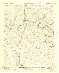
1936 Map of Farmington
USGS Topo · Published 1936About this map
The Duck River winds through this rural landscape in the mid-1930s, creating a natural divide between Marshall and Bedford counties. Settlement is centered around small crossroads such as Farmington, Chapel Hill, and Richcreek, while the presence of Wilhoite Mills along the riverbanks suggests the lingering importance of water-powered industry. The map reveals a dense network of local landmarks essential for genealogical research, including numerous family-named burial grounds like Mc Quiddy Cem, Swanson Cem, and Haskins Cem. This era of development is marked by the Tennessee Electric Power Company Highway Trans Line, which cuts across the terrain alongside established routes like the Nashville and Louisville Highway. Several rural education and worship centers, such as Smyrna Sch and Mt Lebanon Ch, anchor the surrounding farmsteads.
Find a feature on this map
47 named features on this map. Tap any name to fly to it.
Don’t see what you’re looking for? This feature index may not catch every label — zoom into the map to look around manually.
Map Details
Editions of this 1936 Farmington Map
This is the sole edition of this map. No revisions or reprints were ever made.
Other maps of this area

1936 · Chapel Hill
USGS Topo · 1:24,000

1936 · Rover
USGS Topo · 1:24,000

1936 · Belfast
USGS Topo · 1:24,000

1936 · Lewisburg
USGS Topo · 1:24,000

1936 · Verona
USGS Topo · 1:24,000

1936 · Rally Hill
USGS Topo · 1:24,000

1936 · Unionville
USGS Topo · 1:24,000

1936 · Bedford
USGS Topo · 1:24,000

1944 · Shelbyville
USGS Topo · 1:100,000
1947 · Farmington
USGS Topo · 1:24,000