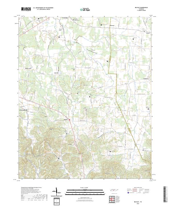
2022 Map of Belfast
USGS Topo · Published 2022About this map
The Farmington Engagement Confederate Cem serves as a silent reminder of the Civil War history that shaped this landscape in Marshall and Bedford counties. The terrain transitions from the relatively open Liberty Valley in the north to the more complex ridges and hollows of the south, where Elk Ridge and Poplar Ridge dominate. Small rural communities like Belfast, Farmington, and Palmetto are connected by a network of country lanes, including Old Farmington Rd and Fishing Ford Rd. Genealogists will find a high density of family and community burial grounds, such as Bills Cem, Head Springs Cem, and Temple Cem. The drainage patterns of East Rock Creek and Belfast Cr provide the natural structure for a region that maintains a largely agricultural and residential character, anchored on the western edge by the outskirts of Lewisburg.
Find a feature on this map
89 named features on this map. Tap any name to fly to it.
Don’t see what you’re looking for? This feature index may not catch every label — zoom into the map to look around manually.
Map Details
Editions of this 2022 Belfast Map
This is the sole edition of this map. No revisions or reprints were ever made.
Other maps of this area

1936 · Farmington
USGS Topo · 1:24,000

1936 · Belfast
USGS Topo · 1:24,000

1936 · Cornersville
USGS Topo · 1:24,000

1936 · Lewisburg
USGS Topo · 1:24,000

1936 · Belleville
USGS Topo · 1:24,000

1936 · Verona
USGS Topo · 1:24,000

1936 · Petersburg
USGS Topo · 1:24,000

1936 · Unionville
USGS Topo · 1:24,000

1936 · Bedford
USGS Topo · 1:24,000

1944 · Shelbyville
USGS Topo · 1:100,000