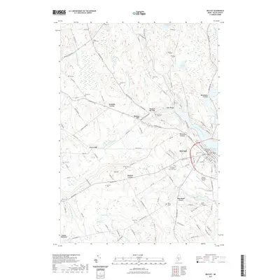
2021 Map of Belfast
USGS Topo · Published 2021About this map
Belfast Bay serves as the gateway to this coastal Waldo County landscape, where the Passagassawakeag River meets the sea. The city of Belfast functions as a regional hub, anchored by the Waldo County Superior Court and The University of Maine Hutchinson Center. Beyond the urban center, the map reveals a constellation of smaller crossroads and historic locales like Shermans Corner, City Point, and Dog Island Corner. This modern survey reflects the enduring settlement patterns of coastal Maine, tracing the paths of the Little River and Wescot Stream as they weave through the surrounding hills. Genealogists will find a high density of burial grounds throughout the countryside, from the Head of the Tide Cem to the South Belfast Cem, providing a clear record of the area's family history and community development.
Find a feature on this map
144 named features on this map. Tap any name to fly to it.
Don’t see what you’re looking for? This feature index may not catch every label — zoom into the map to look around manually.
Map Details
Editions of this 2021 Belfast Map
This is the sole edition of this map. No revisions or reprints were ever made.
Other maps of this area

1900 · Bucksport
USGS Topo · 1:62,500

1902 · Bucksport
USGS Topo · 1:62,500

1902 · Castine
USGS Topo · 1:62,500

1904 · Castine
USGS Topo · 1:62,500

1905 · Penobscot Bay
USGS Topo · 1:125,000

1915 · Belfast
USGS Topo · 1:62,500

1917 · Belfast
USGS Topo · 1:62,500

1932 · Brooks
USGS Topo · 1:62,500

1941 · Belfast
USGS Topo · 1:62,500

1941 · Castine
USGS Topo · 1:62,500