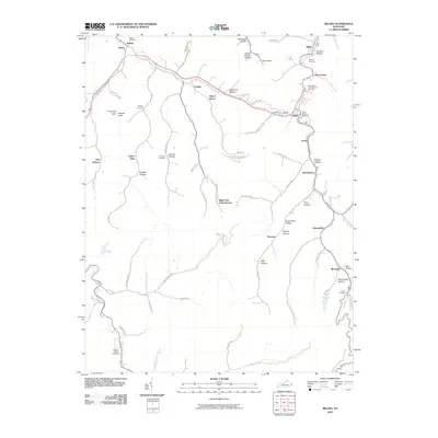
2010 Map of Belfry
USGS Topo · Published 2010About this map
Belfry and the surrounding hollows of eastern Kentucky are defined by a complex network of narrow valleys and winding creeks, where small settlements like Pinsonfork and McAndrews occupy the limited level ground between steep ridges. The drainage of Meathouse Fork and Rockhouse Fork dictates the path of local life and travel, branching into numerous named draws such as Octavia Hollow and Grigger Hollow. This landscape is deeply tied to family lineage, as evidenced by several private burial grounds including the Deskins Family Cemetery and the W J May Cemetery. Higher elevations are marked by landmarks such as the Canada Knob Lookout Tower, providing a panoramic vantage over the dense forest canopy. The arrangement of coal-era hamlets like Stone and Huddy illustrates the persistence of tight-knit communities within the rugged geography of the Cumberland Plateau.
Find a feature on this map
69 named features on this map. Tap any name to fly to it.
Don’t see what you’re looking for? This feature index may not catch every label — zoom into the map to look around manually.
Map Details
Editions of this 2010 Belfry Map
This is the sole edition of this map. No revisions or reprints were ever made.
Other maps of this area

1886 · Grundy
USGS Topo · 1:125,000

1887 · Warfield
USGS Topo · 1:125,000

1890 · Grundy
USGS Topo · 1:125,000

1891 · Warfield
USGS Topo · 1:125,000

1892 · Grundy
USGS Topo · 1:125,000

1909 · Matewan
USGS Topo · 1:48,000

1914 · Hurley
USGS Topo · 1:48,000

1915 · Regina
USGS Topo · 1:48,000

1915 · Hurley
USGS Topo · 1:48,000

1915 · Williamson
USGS Topo · 1:48,000