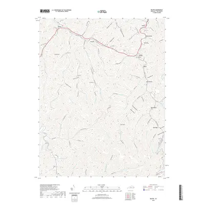
2019 Map of Belfry
USGS Topo · Published 2019About this map
The mountain settlements of eastern Kentucky are meticulously documented here, showing a landscape defined by steep narrow valleys and winding creek beds. Communities such as Belfry, Sharondale, and Huddy are concentrated along the main thoroughfares, while smaller locales like McVeigh and Pinsonfork sit deeper within the hollows. Genealogists will find significant value in the mapped family sites, including the Deskins Family Cem, Smith Cem, and Stump Cem. The terrain is characterized by a dense network of watercourses like Johns Cr and Pond Fork, which historically dictated the pattern of human habitation in this region. This modern survey illustrates the enduring relationship between the central Appalachian topography and the roads that snake through places like Blackburn Hollow and Grigger Hollow, following the natural drainage of the Meathouse Fork.
Find a feature on this map
97 named features on this map. Tap any name to fly to it.
Don’t see what you’re looking for? This feature index may not catch every label — zoom into the map to look around manually.
Map Details
Editions of this 2019 Belfry Map
This is the sole edition of this map. No revisions or reprints were ever made.
Other maps of this area

1886 · Grundy
USGS Topo · 1:125,000

1887 · Warfield
USGS Topo · 1:125,000

1890 · Grundy
USGS Topo · 1:125,000

1891 · Warfield
USGS Topo · 1:125,000

1892 · Grundy
USGS Topo · 1:125,000

1909 · Matewan
USGS Topo · 1:48,000

1914 · Hurley
USGS Topo · 1:48,000

1915 · Regina
USGS Topo · 1:48,000

1915 · Hurley
USGS Topo · 1:48,000

1915 · Williamson
USGS Topo · 1:48,000