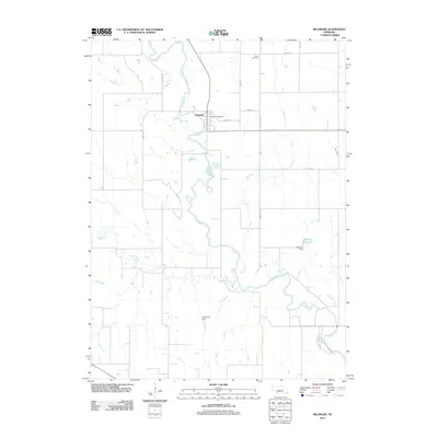
2011 Map of Belgrade
USGS Topo · Published 2011About this map
Belgrade serves as the central hub of this eastern Nebraska landscape, situated near a prominent bend in the Cedar River. The settlement is clearly defined by its street grid, including 6th St, and the presence of the Belgrade Post Office. The surrounding rural topography is shaped by the winding paths of Timber Creek and Ash Creek, which feed into the river system. Local infrastructure is marked by several water management features, notably the Gdowski Reservoir and its associated Gdowski Dam, along with Hellbusch Dam further south. These points of interest, combined with the Main Cemetery located north of the town center, provide a detailed view of the community's layout and essential local landmarks in the early twenty-first century.
Find a feature on this map
18 named features on this map. Tap any name to fly to it.
Don’t see what you’re looking for? This feature index may not catch every label — zoom into the map to look around manually.
Map Details
Editions of this 2011 Belgrade Map
This is the sole edition of this map. No revisions or reprints were ever made.
Other maps of this area

1896 · Stromsburg
USGS Topo · 1:125,000

1899 · St. Paul
USGS Topo · 1:125,000

1954 · Cedar Rapids
USGS Topo · 1:24,000

1954 · Belgrade
USGS Topo · 1:24,000

1954 · Belgrade NW
USGS Topo · 1:24,000

1954 · Cedar Rapids SE
USGS Topo · 1:24,000

1955 · Belgrade SW
USGS Topo · 1:24,000

1955 · Broken Bow
USGS Topo · 1:250,000

1955 · Belgrade SE
USGS Topo · 1:24,000

1955 · Fremont
USGS Topo · 1:250,000