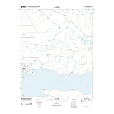
2010 Map of Belhaven
USGS Topo · Published 2010About this map
The town of Belhaven serves as the focal point for this coastal survey, where the Pungo River meets the smaller waters of Pantego Creek and Pungo Creek. The shoreline is defined by several distinct family and geographical markers, including Battallina Point, Tooleys Point, and Haystack Point, reflecting a landscape deeply connected to the river and its tributaries. Moving inland, the map reveals a network of low-lying ridges and landing sites, such as Arnolds Ridge, Beech Ridge, and Piney Grove Landing, which suggest a long history of water-based access and agricultural transition.
Find a feature on this map
46 named features on this map. Tap any name to fly to it.
Don’t see what you’re looking for? This feature index may not catch every label — zoom into the map to look around manually.
Map Details
Editions of this 2010 Belhaven Map
This is the sole edition of this map. No revisions or reprints were ever made.
Other maps of this area

1914 · Belhaven
USGS Topo · 1:48,000

1916 · Belhaven
USGS Topo · 1:62,500

1943 · Columbia
USGS Topo · 1:125,000

1943 · Plymouth
USGS Topo · 1:125,000

1951 · Ransomville
USGS Topo · 1:24,000

1951 · Pamlico Beach
USGS Topo · 1:24,000

1951 · Belhaven
USGS Topo · 1:24,000

1951 · Pantego
USGS Topo · 1:24,000

1951 · Scranton
USGS Topo · 1:24,000

1951 · Ponzer
USGS Topo · 1:24,000