
1951 Map of Pantego
USGS Topo · Published 1953About this map
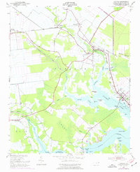
Pantego and Belhaven serve as the primary hubs for this tidewater landscape, where the Norfolk Southern rail line cuts across a territory defined by intricate drainage and reclaimed lowlands. The 1951 survey reveals a sophisticated hydraulic system including the Intercepting Canal and various unnamed ditches designed to manage the water levels of the surrounding Pungo Swamp. These engineering efforts supported a rural economy visible in the numerous small settlements like Wilkinson and Bishops Cross.
Find a feature on this map
55 named features on this map. Tap any name to fly to it.
Don’t see what you’re looking for? This feature index may not catch every label — zoom into the map to look around manually.
Map Details
Editions of this 1951 Pantego Map
2 editions found
Other maps of this area

1914 · Belhaven
USGS Topo · 1:48,000

1916 · Belhaven
USGS Topo · 1:62,500

1943 · Plymouth
USGS Topo · 1:125,000

1950 · Pinetown
USGS Topo · 1:24,000

1951 · Bath
USGS Topo · 1:24,000

1951 · Ransomville
USGS Topo · 1:24,000

1951 · Pamlico Beach
USGS Topo · 1:24,000

1951 · Belhaven
USGS Topo · 1:24,000

1953 · Rocky Mount
USGS Topo · 1:250,000

1954 · Rocky Mount
USGS Topo · 1:250,000