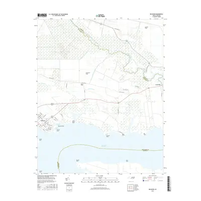
2016 Map of Belhaven
USGS Topo · Published 2016About this map
Belhaven sits at the western edge of this coastal landscape, where the street grid transitions into the complex wetlands of Pantego Swamp and the surrounding Beaufort County countryside. The area is defined by its maritime and agricultural connectivity, featuring the engineered path of the Intracoastal Waterway and a network of drainage canals like the Pungo River Canal and Pungo Lake Canal that have historically shaped the drainage of these low-lying ridges. Moving east, the small settlement of Leechville marks the crossing into Hyde County at the head of the river marshes.
Find a feature on this map
63 named features on this map. Tap any name to fly to it.
Don’t see what you’re looking for? This feature index may not catch every label — zoom into the map to look around manually.
Map Details
Editions of this 2016 Belhaven Map
This is the sole edition of this map. No revisions or reprints were ever made.
Other maps of this area

1914 · Belhaven
USGS Topo · 1:48,000

1916 · Belhaven
USGS Topo · 1:62,500

1943 · Columbia
USGS Topo · 1:125,000

1943 · Plymouth
USGS Topo · 1:125,000

1951 · Ransomville
USGS Topo · 1:24,000

1951 · Pamlico Beach
USGS Topo · 1:24,000

1951 · Belhaven
USGS Topo · 1:24,000

1951 · Pantego
USGS Topo · 1:24,000

1951 · Scranton
USGS Topo · 1:24,000

1951 · Ponzer
USGS Topo · 1:24,000