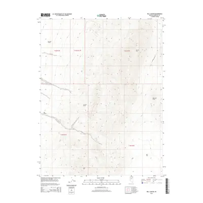
2014 Map of Bell Canyon
USGS Topo · Published 2014About this map
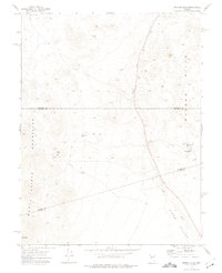
Fairview Peak and Slate Mtn anchor this high-desert basin and range landscape in Churchill County, where dramatic vertical relief defines the Great Basin geography. The map illustrates a region shaped by tectonic activity, most notably evidenced by Earthquake Fault Rd skirting the eastern edge of the peaks. This corridor reveals the stark transition from the alluvial fans of Fairview Valley and Bell Flat to the sharp ridges of the Fairview Range and the West Gate Range. The drainage of Bell Canyon cuts through the southwestern terrain, providing a natural conduit through the mountains. This 2014 survey serves as a precise record of the public land survey system divisions across these desert summits, showing the township and range lines that segment this sparsely settled mining and ranching territory.
Find a feature on this map
13 named features on this map. Tap any name to fly to it.
Don’t see what you’re looking for? This feature index may not catch every label — zoom into the map to look around manually.
Map Details
Editions of this 2014 Bell Canyon Map
This is the sole edition of this map. No revisions or reprints were ever made.
Other maps of this area

1908 · Carson Sink
USGS Topo · 1:250,000

1910 · Carson Sink
USGS Topo · 1:250,000

1957 · Reno
USGS Topo · 1:250,000

1959 · Reno
USGS Topo · 1:250,000

1960 · Reno
USGS Topo · 1:250,000
1972 · Bell Mountain
USGS Topo · 1:24,000
1972 · Slate Mtn
USGS Topo · 1:24,000
1972 · Bell Canyon
USGS Topo · 1:24,000
1972 · Broken Hills
USGS Topo · 1:24,000
1972 · West Gate
USGS Topo · 1:24,000