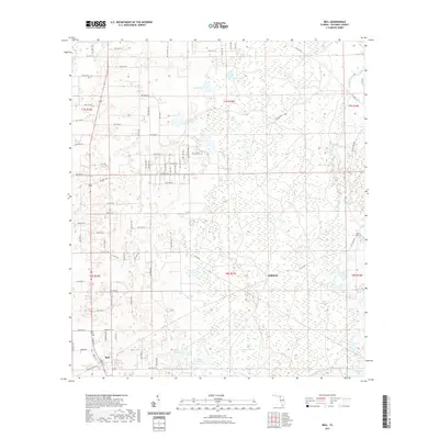
2021 Map of Bell
USGS Topo · Published 2021About this map
Bell and the nearby settlement of Williford anchor this detailed 2021 study of north-central Florida. The landscape is characterized by its numerous localized depressions and water bodies, ranging from larger features like Sevenmile Lake and Half Moon Pond to smaller named basins such as Bone Pond, Coop Pond, and Bay Horse Pond. The northern reaches of the quadrangle are marked by an extensive network of rural lanes, including NW 91st Ln and NW 80th St, which trace the legacy of the Public Land Survey System. Local history is evidenced by the presence of Mount Horeb Cem in the eastern section and the open expanse of Smiths Prairie. The terrain transition is subtly captured through labeled features like Poley Cow Pen and Cannon Pond, illustrating the traditional land use and water management patterns common to Gilchrist County.
Find a feature on this map
63 named features on this map. Tap any name to fly to it.
Don’t see what you’re looking for? This feature index may not catch every label — zoom into the map to look around manually.
Map Details
Editions of this 2021 Bell Map
This is the sole edition of this map. No revisions or reprints were ever made.
Other maps of this area

1954 · Gainesville
USGS Topo · 1:250,000

1958 · Gainesville
USGS Topo · 1:250,000

1959 · Gainesville
USGS Topo · 1:250,000

1968 · Waters Lake
USGS Topo · 1:24,000

1968 · Fourmile Lake
USGS Topo · 1:24,000

1968 · Branford
USGS Topo · 1:24,000

1968 · Hatchbend
USGS Topo · 1:24,000
1968 · Hildreth
USGS Topo · 1:24,000
1968 · Wannee
USGS Topo · 1:24,000
1968 · Bell
USGS Topo · 1:24,000