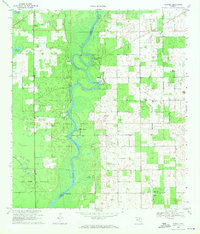
1968 Map of Wannee
USGS Topo · Published 1971About this map
The Suwannee River carves a winding path through the borderlands of Dixie and Gilchrist counties, anchoring a landscape defined by riverside landings and freshwater springs. This late 1960s survey illustrates a region where life centered on the water, featuring several recreational Picnic Areas and named access points such as Veg Landing and McCrabb Landing. The map provides excellent detail for genealogists, documenting rural church and cemetery sites like McCrabb Church and Fayetteville Cemetery that served the dispersed communities of Wannee, Fletcher, and Priscilla. Large natural features, including Tomlinson Prairie and Old Town Hammock, dominate the terrain, interspersed with evidence of local resource extraction at various Quarries and a Sandpit. The transition from the dense hammock land to the open water of Sun Springs and Hart Springs highlights the unique karst topography of northern Florida.
Find a feature on this map
23 named features on this map. Tap any name to fly to it.
Don’t see what you’re looking for? This feature index may not catch every label — zoom into the map to look around manually.
Map Details
Editions of this 1968 Wannee Map
4 editions found
Other maps of this area

1954 · Eugene
USGS Topo · 1:24,000

1954 · Cross City East
USGS Topo · 1:24,000

1954 · Mallory Swamp SE
USGS Topo · 1:24,000

1954 · Gainesville
USGS Topo · 1:250,000

1956 · Mallory Swamp SE
USGS Topo · 1:25,000

1958 · Gainesville
USGS Topo · 1:250,000

1959 · Gainesville
USGS Topo · 1:250,000

1968 · Fourmile Lake
USGS Topo · 1:24,000

1968 · Hatchbend
USGS Topo · 1:24,000

1968 · Trenton
USGS Topo · 1:24,000