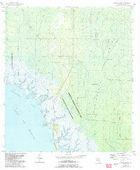
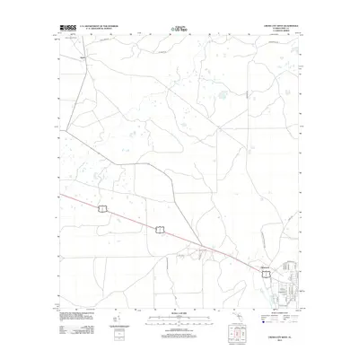
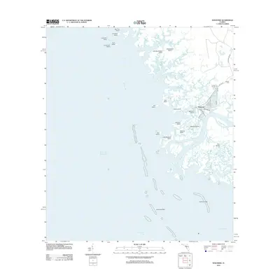
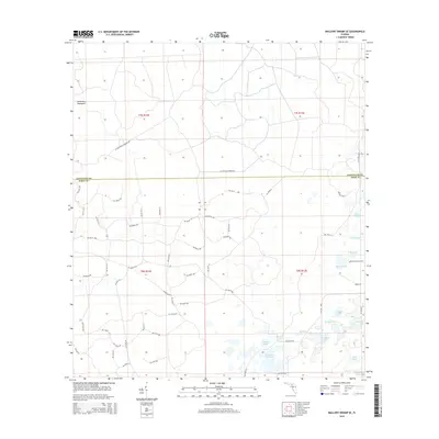
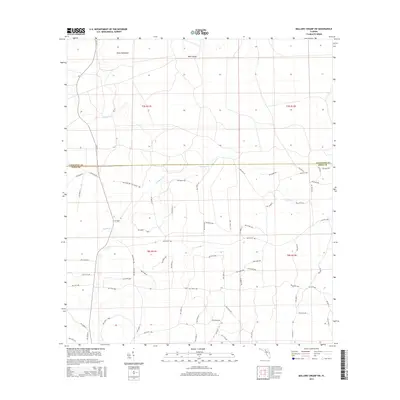
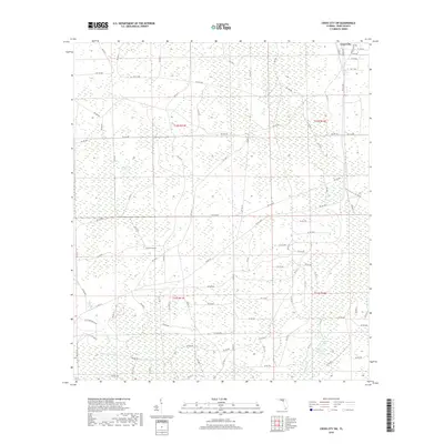
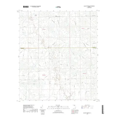
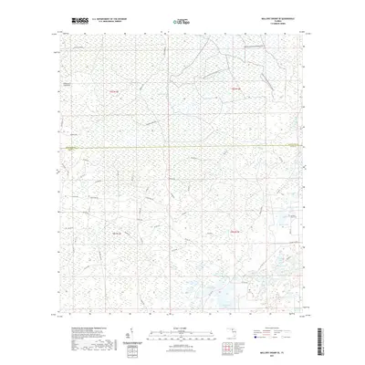
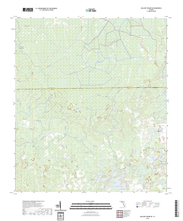
1956 Map of Mallory Swamp SE
USGS Topo · Published 1956About this map
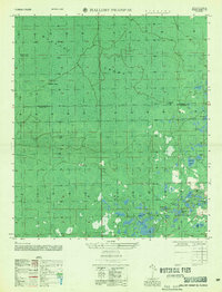
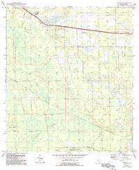
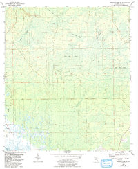
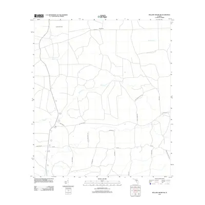
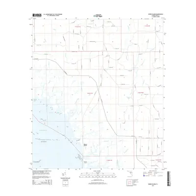
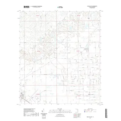
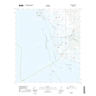
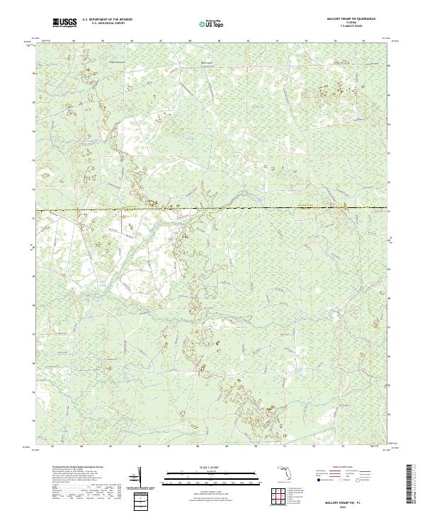
Mallory Swamp dominates this mid-1950s landscape, spanning the border between Lafayette and Dixie Counties. The terrain is characterized by a dense network of wetlands, bays, and hammocks, including the curiously named Deserters Hammock in the northwest. Human presence is sparse, marked primarily by isolated sites like McElvain Camp and Cow Camp, which likely served the regional timber or cattle interests of the era. To the southeast, the geography becomes defined by a cluster of named water bodies such as Matthis Lake, Cemetery Lake, and Governor Hill Lake. Genealogists and local historians will find value in the location of Pleasant Grove Cem, situated near a concentrated group of lakes like Lord Lake and Barpost Lake. The presence of Mill Pond and Board Pile Bay points to the area's historical reliance on local water resources and timber management in this remote section of the Florida interior.
Find a feature on this map
21 named features on this map. Tap any name to fly to it.
Don’t see what you’re looking for? This feature index may not catch every label — zoom into the map to look around manually.
Map Details
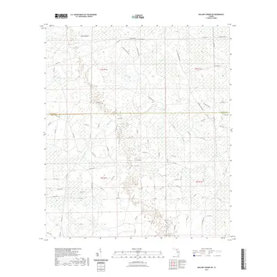
Editions of this 1956 Mallory Swamp SE Map
This is the sole edition of this map. No revisions or reprints were ever made.
Historical Maps of Dixie County Through Time
78 maps found
1954 Cross City East
Dixie County, FL
1954 Cross City SW
Dixie County, FL
1954 Cross City West
Dixie County, FL
1954 Eugene
Dixie County, FL
1954 Jena
Dixie County, FL
1954 Mallory Swamp SE
Dixie County, FL
1954 Mallory Swamp SW
Dixie County, FL
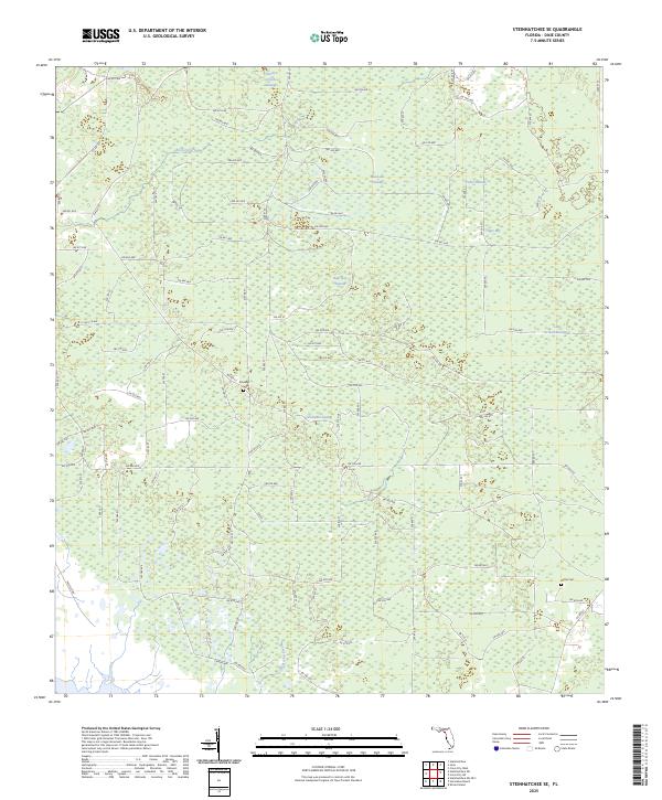
1954 Steinhatchee SE
Dixie County, FL
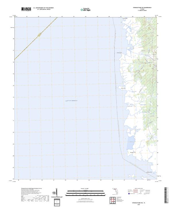
1954 Steinhatchee SW
Dixie County, FL
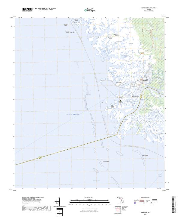
1954 Suwannee
Dixie County, FL
1954 Vista
Dixie County, FL
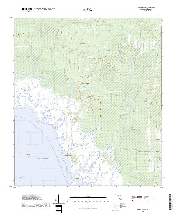
1955 Shired Island
Dixie County, FL
1956 Mallory Swamp SE
Dixie County, FL
1978 Cedar Keys
Dixie County, FL
2012 Cross City East
Dixie County, FL
2012 Cross City SW
Dixie County, FL
2012 Cross City West
Dixie County, FL
2012 Eugene
Dixie County, FL
2012 Jena
Dixie County, FL
2012 Mallory Swamp SE
Dixie County, FL
2012 Mallory Swamp SW
Dixie County, FL
2012 Shired Island
Dixie County, FL
2012 Steinhatchee SE
Dixie County, FL
2012 Steinhatchee SW
Dixie County, FL
2012 Suwannee
Dixie County, FL
2012 Vista
Dixie County, FL
2015 Cross City East
Dixie County, FL
2015 Cross City SW
Dixie County, FL
2015 Cross City West
Dixie County, FL
2015 Eugene
Dixie County, FL

2015 Jena
Dixie County, FL
2015 Mallory Swamp SE
Dixie County, FL
2015 Mallory Swamp SW
Dixie County, FL
2015 Shired Island
Dixie County, FL
2015 Steinhatchee SE
Dixie County, FL

2015 Steinhatchee SW
Dixie County, FL
2015 Suwannee
Dixie County, FL

2015 Vista
Dixie County, FL
2018 Cross City East
Dixie County, FL
2018 Cross City SW
Dixie County, FL
2018 Cross City West
Dixie County, FL
2018 Eugene
Dixie County, FL
2018 Jena
Dixie County, FL

2018 Mallory Swamp SE
Dixie County, FL
2018 Mallory Swamp SW
Dixie County, FL

2018 Shired Island
Dixie County, FL
2018 Steinhatchee SE
Dixie County, FL
2018 Steinhatchee SW
Dixie County, FL
2018 Suwannee
Dixie County, FL

2018 Vista
Dixie County, FL
2021 Cross City East
Dixie County, FL
2021 Cross City SW
Dixie County, FL
2021 Cross City West
Dixie County, FL

2021 Eugene
Dixie County, FL
2021 Jena
Dixie County, FL
2021 Mallory Swamp SE
Dixie County, FL
2021 Mallory Swamp SW
Dixie County, FL
2021 Shired Island
Dixie County, FL

2021 Steinhatchee SE
Dixie County, FL
2021 Steinhatchee SW
Dixie County, FL
2021 Suwannee
Dixie County, FL
2021 Vista
Dixie County, FL
2024 Cross City East
Dixie County, FL
2024 Cross City SW
Dixie County, FL
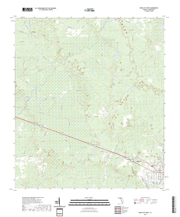
2024 Cross City West
Dixie County, FL
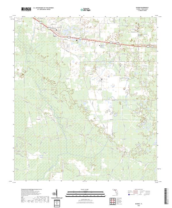
2024 Eugene
Dixie County, FL
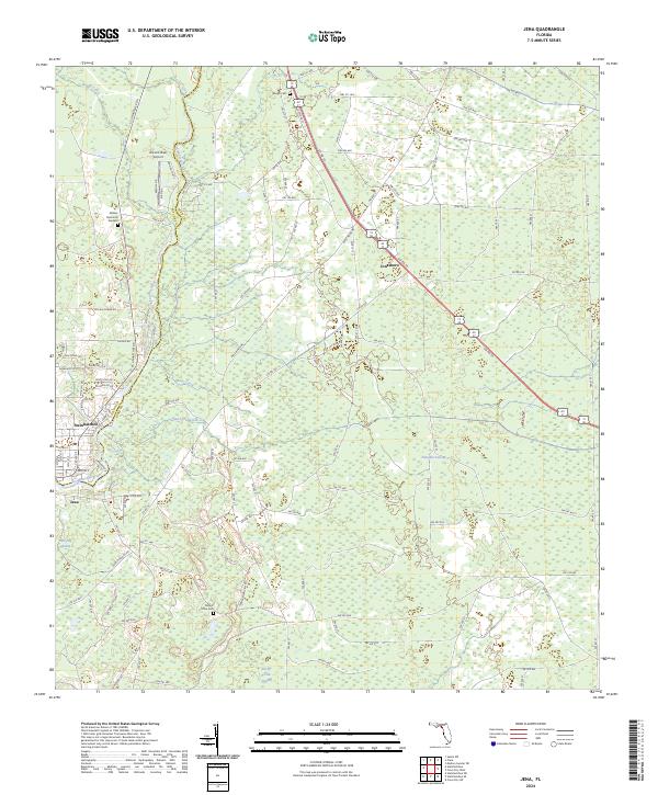
2024 Jena
Dixie County, FL
2024 Mallory Swamp SE
Dixie County, FL
2024 Mallory Swamp SW
Dixie County, FL
2024 Shired Island
Dixie County, FL

2024 Steinhatchee SE
Dixie County, FL
2024 Steinhatchee SW
Dixie County, FL

2024 Suwannee
Dixie County, FL
2024 Vista
Dixie County, FL
2025 Shired Island
Dixie County, FL
2025 Steinhatchee SE
Dixie County, FL
2025 Steinhatchee SW
Dixie County, FL
2025 Suwannee
Dixie County, FL