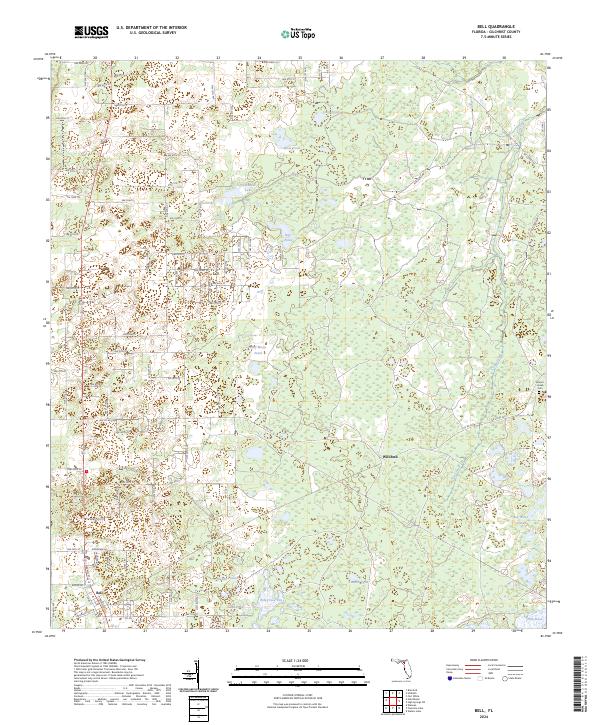
2024 Map of Bell
USGS Topo · Published 2024About this map
Bell sits at the southwestern edge of this northern Gilchrist County survey, where a grid of rural roads fans out into a landscape defined by seasonal water and open prairies. The terrain is a complex mosaic of karst features, including numerous named depressions such as Coop Pond, Bone Pond, and Sevenmile Lake. This drainage pattern suggests a limestone-rich geography where water often collects in isolated basins rather than flowing through integrated river systems, though Cow Creek provides some drainage to the east.
Find a feature on this map
63 named features on this map. Tap any name to fly to it.
Don’t see what you’re looking for? This feature index may not catch every label — zoom into the map to look around manually.
Map Details
Editions of this 2024 Bell Map
This is the sole edition of this map. No revisions or reprints were ever made.
Other maps of this area

1954 · Gainesville
USGS Topo · 1:250,000

1958 · Gainesville
USGS Topo · 1:250,000

1959 · Gainesville
USGS Topo · 1:250,000

1968 · Waters Lake
USGS Topo · 1:24,000

1968 · Fourmile Lake
USGS Topo · 1:24,000

1968 · Branford
USGS Topo · 1:24,000

1968 · Hatchbend
USGS Topo · 1:24,000
1968 · Hildreth
USGS Topo · 1:24,000
1968 · Wannee
USGS Topo · 1:24,000
1968 · Bell
USGS Topo · 1:24,000