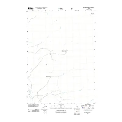
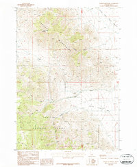
2011 Map of Bell Mountain
USGS Topo · Published 2011About this map
The settlement of Clyde serves as a lone outpost in this 2011 survey of the high-elevation terrain within Butte County. The landscape is defined by the drainage systems of the Little Lost River and Wet Creek, which collect waters from several drainages including Cedar Run Creek and Williams Creek. To the north, the terrain rises significantly toward the summit of Bell Mountain, overlooking the alpine geography of Birch Basin and Foss Mountain. This U.S. Forest Service and USGS collaboration reflects a modern era of land management, detailing the network of Forest Development Roads like NFD 404 Rd and NFD 128 Rd that navigate the steep canyons. Water sources are critical identifiers in this environment, with locations such as Mud Spring, Blind Springs, and South Fork Meadow Canyon marking essential points of interest in an otherwise high-desert and montane wilderness.
Find a feature on this map
19 named features on this map. Tap any name to fly to it.
Don’t see what you’re looking for? This feature index may not catch every label — zoom into the map to look around manually.
Map Details
Editions of this 2011 Bell Mountain Map
This is the sole edition of this map. No revisions or reprints were ever made.
Other maps of this area

1955 · Dubois
USGS Topo · 1:250,000

1956 · Nicholia
USGS Topo · 1:62,500

1957 · Diamond Peak
USGS Topo · 1:62,500

1957 · Gilmore
USGS Topo · 1:62,500

1957 · Hawley Mountain
USGS Topo · 1:62,500

1958 · Dubois
USGS Topo · 1:250,000
1987 · Fallert Springs
USGS Topo · 1:24,000
1987 · Mulkey Bar
USGS Topo · 1:24,000
1987 · Nicholia
USGS Topo · 1:24,000
1987 · Hawley Mountain
USGS Topo · 1:24,000