
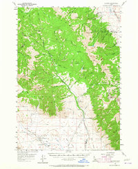
1957 Map of Gilmore
USGS Topo · Published 1958About this map
The Latest Out Mine and Mountain Boy Mine represent the industrial core of the Lemhi Range during the mid-1950s, marking a landscape defined by significant high-altitude mineral extraction. Located near the settlement of Gilmore, these workings are clustered among steep peaks such as Portland Mtn and Nigger Peak, connected to the valley floor by a dedicated mining Grade. This survey illustrates the convergence of three major public lands—the Salmon National Forest, Challis National Forest, and Targhee National Forest—across the rugged Lemhi and Custer county line.
Find a feature on this map
80 named features on this map. Tap any name to fly to it.
Don’t see what you’re looking for? This feature index may not catch every label — zoom into the map to look around manually.
Map Details
Editions of this 1957 Gilmore Map
3 editions found
Other maps of this area

1935 · Borah Peak
USGS Topo · 1:125,000

1938 · Borah Peak
USGS Topo · 1:125,000

1955 · Dubois
USGS Topo · 1:250,000

1956 · Leadore
USGS Topo · 1:62,500

1956 · Morrison Lake
USGS Topo · 1:62,500

1956 · Patterson
USGS Topo · 1:62,500

1956 · Donkey Hills
USGS Topo · 1:62,500

1956 · Nicholia
USGS Topo · 1:62,500

1957 · Diamond Peak
USGS Topo · 1:62,500

1957 · Hawley Mountain
USGS Topo · 1:62,500