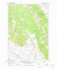
1957 Map of Gilmore
USGS Topo · Published 1980About this map
The settlement of Gilmore and its surrounding mining district dominate this mid-century survey of the Lemhi Range. High-altitude mining operations are concentrated on the eastern slopes of Portland Mtn, where a cluster of sites including the Portland Mine, Latest Out Mine, and Mountain Boy Mine mark the industrial activity of the era. The infrastructure of earlier extraction is visible in the Gilmore and Pittsburgh Railroad (Abandoned Grade), which provides a historical record of the logistical challenges in transporting ore from these remote peaks to the valley floor.
Find a feature on this map
75 named features on this map. Tap any name to fly to it.
Don’t see what you’re looking for? This feature index may not catch every label — zoom into the map to look around manually.
Map Details
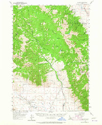
Editions of this 1957 Gilmore Map
3 editions found
Other maps of this area

1935 · Borah Peak
USGS Topo · 1:125,000

1938 · Borah Peak
USGS Topo · 1:125,000

1955 · Dubois
USGS Topo · 1:250,000

1956 · Leadore
USGS Topo · 1:62,500

1956 · Morrison Lake
USGS Topo · 1:62,500

1956 · Patterson
USGS Topo · 1:62,500

1956 · Donkey Hills
USGS Topo · 1:62,500

1956 · Nicholia
USGS Topo · 1:62,500

1957 · Diamond Peak
USGS Topo · 1:62,500

1957 · Gilmore
USGS Topo · 1:62,500