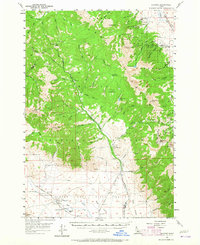
1957 Map of Gilmore
USGS Topo · Published 1965About this map
Gilmore sits at the foot of the mountains on the eastern edge of the Lemhi Range, serving as a hub for the region's historic mining activity. High-altitude operations such as the Portland Mine, Latest Out Mine, and Hilltop Mine are scattered across the slopes of Portland Mtn, reflecting an era of intense resource extraction. The presence of the Gilmore & Pittsburgh RR grade illustrates the vital transportation link that once connected these remote camps to broader markets.
Find a feature on this map
77 named features on this map. Tap any name to fly to it.
Don’t see what you’re looking for? This feature index may not catch every label — zoom into the map to look around manually.
Map Details
Editions of this 1957 Gilmore Map
3 editions found
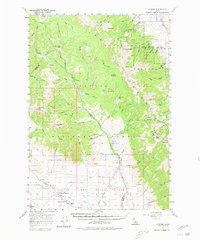
Other maps of this area

1935 · Borah Peak
USGS Topo · 1:125,000

1938 · Borah Peak
USGS Topo · 1:125,000

1955 · Dubois
USGS Topo · 1:250,000

1956 · Leadore
USGS Topo · 1:62,500

1956 · Morrison Lake
USGS Topo · 1:62,500

1956 · Patterson
USGS Topo · 1:62,500

1956 · Donkey Hills
USGS Topo · 1:62,500

1956 · Nicholia
USGS Topo · 1:62,500

1957 · Diamond Peak
USGS Topo · 1:62,500

1957 · Gilmore
USGS Topo · 1:62,500